Introduction
High-resolution UAV data offers cost-effective solutions for conservation challenges in the tropics. Despite their potential, UAVs often focus on technology rather than operational conservation success, exemplifying the research-implementation gap. This issue is notable in mapping tree species populations in moist forests.
Challenges and Objectives
Sustainable use of forest products from tropical trees is crucial for biodiversity conservation, supporting local communities, and climate change mitigation. Current approaches using high-resolution remote sensing data focus on cases with distinctive species phenology or color, which don’t align with management needs. The challenges are two-fold: overcoming technical issues stakeholders face and ensuring conservation tools are accessible and adopted by stakeholders.
Methodology
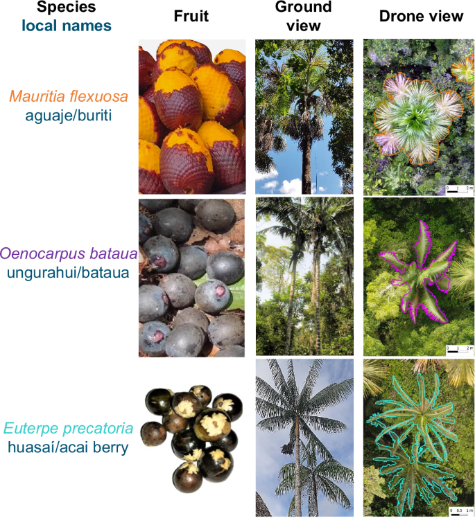
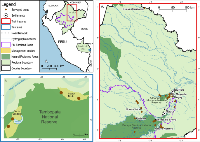
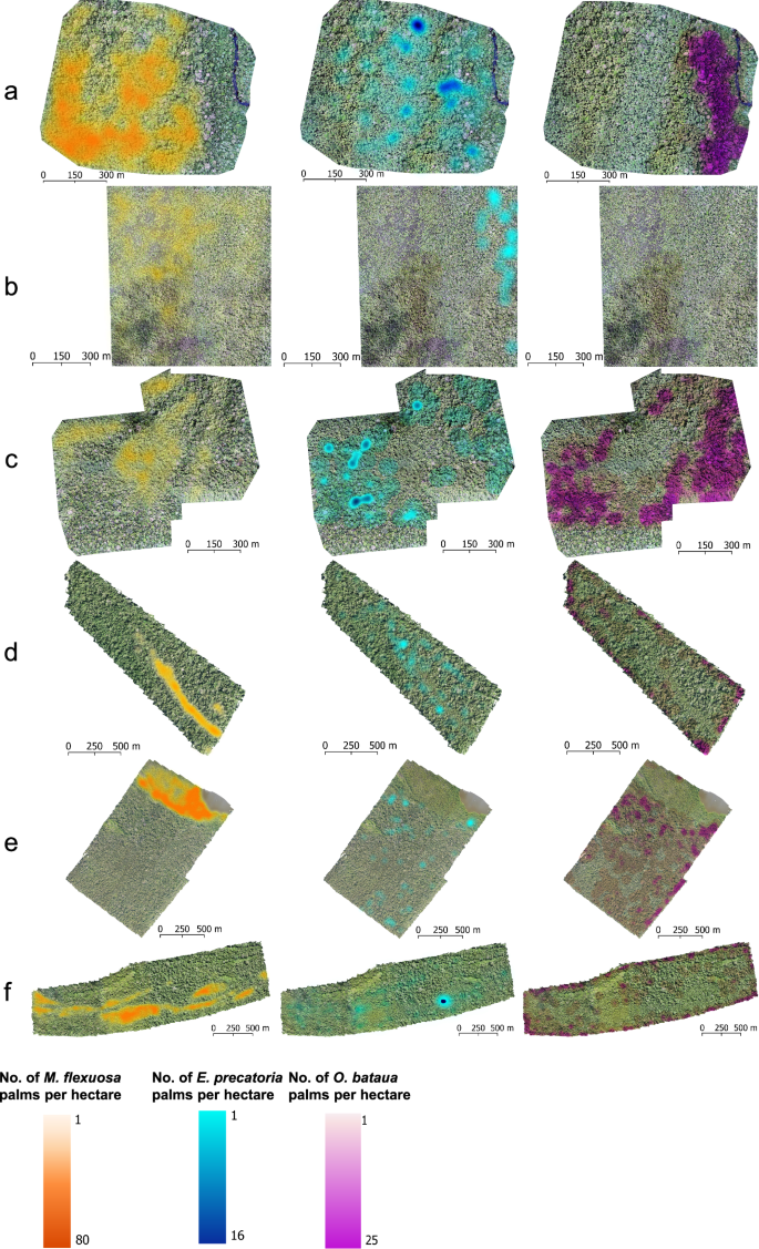
The study addressed these challenges in the context of sustainable harvesting of fruit from arborescent palms in Amazonia. Researchers collected RGB UAV images and GPS location points from multiple sites in Peru. They developed semantic segmentation maps to classify UAV mosaic pixels and trained a model to partition these maps into individual palm crowns.
Results
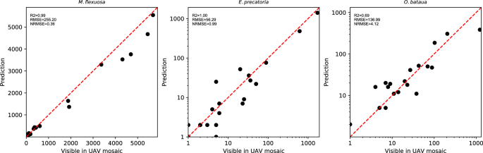
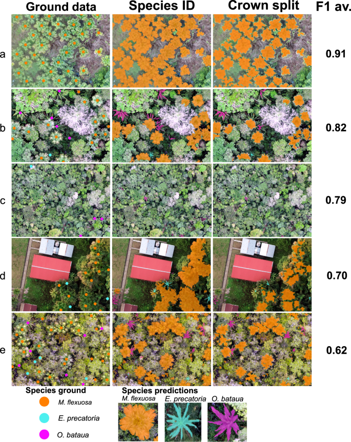
The approach showed high accuracy for detecting Mauritia flexuosa crowns (precision 99%, recall 69%, F1 score 81%) but lower accuracy for Euterpe precatoria and Oenocarpus bataua. The model accurately quantified palm species abundance even in densely clustered populations. The UAV-based method reduced inventory costs by 99% compared to traditional plot-based methods for M. flexuosa.
Cost Analysis
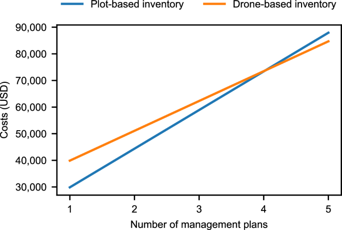
The UAV approach is significantly more cost-effective for mapping and quantifying palm abundance. It reduces total operational costs by 23% compared to plot-based methods. While plot-based methods have lower capital costs, the UAV approach demonstrates a cost advantage once the number of management plans surpasses four.
Conclusion
The UAV-based method provides a practical, cost-effective, and reliable technique for generating essential information for forest management. It has the potential to improve the spatial detail and timeliness of forest monitoring, benefiting stakeholders involved in sustainable palm resource management. Local communities can use it to locate resources more efficiently, while NGOs and government agencies can use it to validate responsible resource use and estimate harvest amounts.